Date: July 16th 2012
Classification: Dillon, Hewitt, Marilyn
Height: 639 metres
County: Tipperary
Distance: 6.31km
Dillon Count: 51
Another mountain 'bagged' when stopping-off on a drive down the country. A detour through the Glen of Aherlow on an overcast day led me to the foot of the cloud-covered Galtee Mountains.
From the north, Cush (or Binnia as Paddy Dillon calls it) looks very impressive, it's cone shape appearing to rear-up steeply from the land below. Indeed, it looks almost impossibly steep from some angles. However, it's profile starts to take on a much more gradual form as you drive towards Clydagh Bridge.
For most, Cush would represent the first mountain on a day of exploring the Galtees. It is most often used as a stepping-stone on the way to Galtybeg and Galtymore. I probably represented a very small subset of walkers that climbed Cush purely for it's own sake. I was also using it to get in a bit of training for a planned walk of the Mourne Wall.
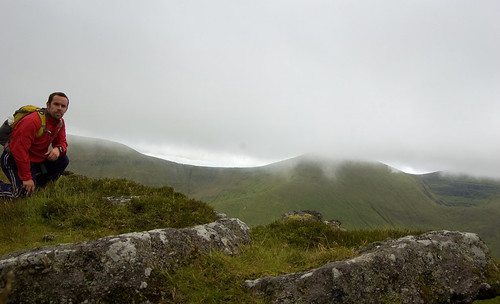
Initial Path Up Cush
I started my walk by parking at Clydagh Bridge forest entrance where there is room for a number of cars. From here, follow the road uphill to a stile on the left which bears a 'No Dogs' sign. Cross the stile and follow an obvious track along the edge of the forest before crossing a fence and heading straight for the summit of Cush.
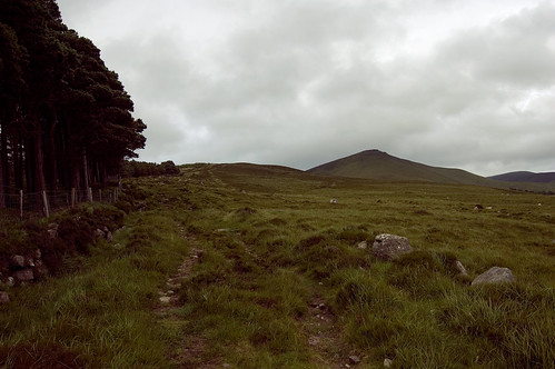
Heading For The Summit
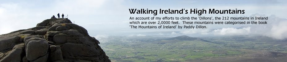
The walk up Cush was indeed steep and a combination of 3 hours driving and ever increasing cross-winds meant that I found the going quite tough. With each upward step, the wind stiffened and by the time I eventually reached the top, it was blowing a gale. To add to that, the gale was blowing in a covering of cloud and the surrounding mountains soon disappeared from view.
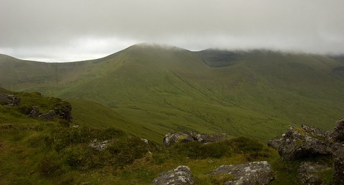
Galtybeg and Galtymore being enveloped in cloud
It's hard to pinpoint the summit of Cush but my GPS reckoned it was close to a gathering of rocks at the edge of a cliff so I settled for that, took a few photos and quickly made my way back down off the mountain. In fact, I made my way a bit too quick and headed off running on a slightly wrong bearing meaning that I had to take a detour at the foot of the mountain to get back on track!
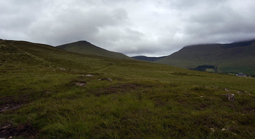
Looking back at Cush and Galtybeg
On a fine sunny day, I'd imagine Cush would be a beautiful walk and that, being the most northerly of the Galtee Mountains, would make an excellent viewing platform for the range. On the day I visited, the strong wind made for difficult walking conditions and the cloud cover robbed me of any views. Hopefully, I'll walk Cush again in better conditions!

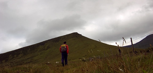
Final climb up Cush