Sugarloaf Hill
Classification: Dillon, Hewitt
Date Walked: 25th April 2010
Height: 663 metres
County: Tipperary/Waterford
Mapsheet: 74
My Dillon Count: 31
Nestled on one side of the Knockmealdown range which straddles the Tipperary and Waterford border, Sugarloaf Hill is far less glamorous than the iconic mountain which shares it's name in County Wicklow. It is however still a popular starting off point for walkers setting off on a hike along the length of the range.
For me, some business in the area later in the day meant that an early start would give me some time to 'bag' a top or two. I had originally intended to climb Knockmealdown itself and tick off another county-top but arriving in Cahir, the whole range was covered by cloud seemingly ready to explode into prolonged rain showers.
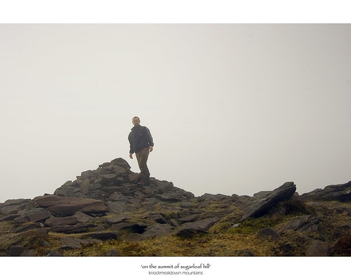
The drive through the sleeping villages of Ballylooby and Clogheen only confirmed my fears as the first rain-drops in a couple of weeks sporadically appeared on my windscreen. The drive up towards the Vee Gap took me into the cloud and as I reached Bay Lough, the mountains had completely disappeared behind a thick veil of cloud so I decided to avail of the car-park and instead take in Sugarloaf Hill. The car-park is overlooked by a grotto and I was slightly freaked out as it would disappear into cloud cover then suddenly reappear.
The walk up Sugarloaf Hill begins behind the Bianconi Hut which was used in the last century for changing horses who had carried out the mammoth task of pulling large carraiges up to the Vee Gap before continuing on along the mountain road. The walk is made easier by the fact that a ruined boundary wall acts as a sure guide all the way to the top. Indeed, there is a well-worn track to the side of the county wall which is quite heavily eroded in places. Falling into a false sense of security and spending far too much time concentrating on my new Garimn Oregon GPS, I wandered away from the wall along what looked to be a gentle meandering path but turned out to be a dead-end and for my stupidity, I had to contour back to the wall through deep rain-sodden heather.
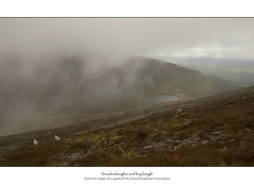
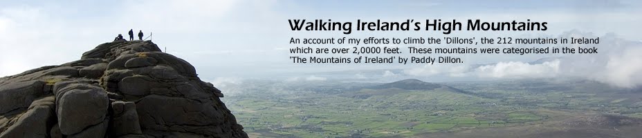
The climb up is quite steep in places and my legs were soon complaining after a three-hour drive but the walk to the top is relatively short. As the wall swings to the right leading towards Knockmealdown, a short walk to the left leads to the summit cairn of Sugarloaf Hill. The popularity of the summit was evident by the various names and shapes formed on the ground from stones presumably taken from either the cairn or the county wall. Views from the cairn were only of the immediate surroundings and it was only by chance that I glimpsed what looked like a second cairn nearby. A short walk leads to this second cairn which although much larger, would appear to be slightly lower than that at the wall.
The walk back down gave me my first chance to try out my Inov8 Roclite trail runners which I had donned for the hike. The runners are very comfortable and handle the wet very well - I'm not sure how suited they are to hill walking given the low heel but they gave me no problems on this short walk.
Typically, it was only close to the bottom that the cloud started to move off opening up views out over the Gap across to the Galtee Mountains. All in all, Sugarloaf Hill is an easy top which would probably provide stunning views on a clear day. The starting elavation of the carpark at the Vee means that the height gain to the summit is not much more than 300 metres - hopefully there'll be a bit less cloud next time!
GPS Log